Reading a Bora Bora Polynesia map for luxury trip planning
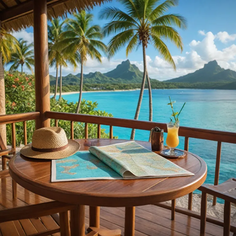
A carefully read Bora Bora Polynesia map is the starting point for any refined stay. When you understand how the main island, the surrounding motu islets, and the turquoise lagoon relate to each other, you can choose a resort that truly matches your expectations for privacy and scenery. This geographic awareness transforms a simple bora island booking into a curated itinerary that respects both your time and your budget.
The volcanic core of Bora Bora rises dramatically with mount Otemanu at its centre, and this peak should anchor how you read any map of the society islands. Many premium travellers want a room or overwater bungalows facing mount Otemanu, so you must check orientation, not just location, when comparing each bora resort on the map. The highest point reaches 727 meters, which means views change significantly depending on whether your resort spa sits on the main island or on a private motu across the bora lagoon.
On most detailed maps of French Polynesia, Bora Bora appears northwest of Tahiti within the Leeward group of the society islands. This broader French Polynesia context matters because many itineraries combine Tahiti, Bora Bora, and sometimes the cook islands on the same long haul trip. When you study a Bora Bora Polynesia map alongside regional charts, you can plan flight connections, day transfers by boat, and even deep sea excursions without wasting precious time in transit.
Positioning of luxury resorts between main island, lagoon, and motu
The most important decision on any Bora Bora Polynesia map is whether to stay on the main island or on a private motu. Resorts on the main island offer easier access to Vaitape, local restaurants, and cultural experiences, while motu properties usually provide greater seclusion and uninterrupted views of mount Otemanu. This choice shapes every later decision, from which bora lagoon tour you book to how you schedule transfers for each person in your party.
On the map, you will notice a ring of coral reef that defines the turquoise lagoon and protects the calm water around the island. Many of the most exclusive overwater bungalows sit on stilts above this shallow water, often aligned so that sunrise or sunset views frame mount Otemanu perfectly. When comparing bora resort options, zoom in on the map to see how far each resort spa extends into the lagoon, because that distance affects privacy, swimming depth, and boat traffic.
Several private motu encircle the bora island, and each private motu has a slightly different character depending on its distance from the main island and the passes in the reef. A resort on a more remote motu may require longer boat transfers but will often offer quieter nights and clearer views of the stars above French Polynesia. By reading the map carefully, you can balance the romance of isolation with the practicality of reaching activities such as coral gardens snorkelling, sea fishing charters, or a sunset cruise departure point.
Using the map to match activities with premium hotel locations
For travellers focused on experiences, a Bora Bora Polynesia map becomes a planning tool rather than a simple illustration. You can mark where the best coral gardens lie within the lagoon, then compare those spots with the jetties of your preferred bora resort to estimate transfer times. This helps you schedule each day efficiently, especially if you want to combine a morning snorkel with an afternoon spa treatment and an evening sunset cruise.
Many luxury guests want to explore mount Otemanu by scenic helicopter flight or guided hike, and the map shows clearly which side of the main island offers the most direct access. If your resort spa sits on a private motu opposite the mountain, you will usually need an additional boat transfer before starting any mount Otemanu tour. By checking these logistics on the map in advance, you avoid rushed mornings and can enjoy a calmer, more elegant pace throughout your stay.
The lagoon also hosts a range of water based activities, from deep sea fishing beyond the reef to gentle paddling above the turquoise lagoon shallows. When you overlay these activity zones on your mental map of Bora Bora and wider French Polynesia, you can choose whether to prioritise quick access to sea fishing charters or to quieter corners ideal for a private motu lunch. This approach turns the map into a personalised concierge, aligning things Bora Bora offers with the specific experiences you value most.
Mapping culinary and cultural experiences around luxury stays
Beyond scenery, a Bora Bora Polynesia map helps you position culinary and cultural highlights in relation to your chosen resort. Many high end travellers want at least one evening in Vaitape or at a renowned fine dining address on the island, so distance and boat schedules matter. Placing your resort spa, the main island village, and key restaurants on the same map allows you to plan refined evenings without long, tiring transfers.
One notable example is the exclusive restaurant Villa Mahana, which many guests pair with a stay in overwater bungalows or a secluded bora resort. Reading the map, you can see how long it takes to reach this address from different motu and from the main island coastal road, then time your sunset cruise or aperitif accordingly. For a detailed perspective on this experience, you may consult an in depth guide to an exclusive fine dining experience on the island before finalising your reservations.
Cultural excursions, such as visits to historical sites or artisan workshops, also appear more clearly when plotted on a map of Bora Bora within French Polynesia. By understanding how these points relate to your hotel, you can design a day that moves gracefully from lagoon activities to encounters with local life. This thoughtful use of the map ensures that each person in your group experiences both the natural beauty of the bora lagoon and the living culture that gives the island its character.
Interpreting lagoon, reef, and depth on premium booking maps
Luxury booking platforms often provide stylised maps of the Bora Bora lagoon, but it is important to interpret these visuals with care. Colour gradients usually indicate depth, with the palest turquoise lagoon tones representing shallow sandbanks and deeper blues marking channels used by boats. When choosing overwater bungalows, you should compare these colours with the layout of each bora resort to understand whether you will step into knee deep water or into a channel suitable for swimming.
The outer reef that encircles the bora island appears as a thin, irregular line on most maps of French Polynesia, yet it plays a major role in your stay. Passes through this reef determine where boats can exit the lagoon for deep sea fishing or scuba diving, and their position affects how long it takes to reach open water. If sea fishing or offshore excursions are priorities, select a resort spa or private motu with relatively direct access to one of these passes.
Within the lagoon, coral gardens form intricate underwater landscapes that are often highlighted on specialised maps used by tour operators. When you see these marked near your preferred private motu or along the main island coast, you can anticipate shorter transfers and more time in the water. This level of map reading allows you to align your French Polynesia itinerary with the finest things Bora Bora offers beneath the surface, from gentle snorkelling to more adventurous lagoon tours.
Designing multi island itineraries with a Bora Bora Polynesia map
Many premium travellers pair Bora Bora with other islands in French Polynesia, and a regional map becomes essential for this level of planning. On a chart of the society islands, you can see how Tahiti, Moorea, and Bora Bora align, then decide whether to add more remote destinations or even a stop in the cook islands. This broader perspective helps you structure flight routes, minimise backtracking, and maintain a smooth rhythm between stays in each bora resort along your journey.
When you overlay flight schedules and boat connections on your Bora Bora Polynesia map, you can identify the most efficient sequence for visiting the main island hubs. For example, some guests prefer to begin in Tahiti for a short acclimatisation, then move to the tranquillity of the bora lagoon, and finally end on another island focused on nature. By planning in this way, each person in your party experiences a coherent narrative rather than a series of disconnected hotel nights.
As you refine your itinerary, remember that “Best time to visit is during the dry season from May to October.” This seasonal guidance, combined with the map, allows you to align key experiences such as a private motu lunch, a sunset cruise, or a mount Otemanu tour with the most favourable conditions. Used thoughtfully, the map becomes more than a navigation tool ; it becomes the framework for a layered, elegant French Polynesia experience that honours both the landscape and your expectations for luxury.
Key statistics for understanding Bora Bora geography
- Area of Bora Bora is approximately 30.55 km², which helps explain why resorts cluster around the limited coastal flatlands and motu islets.
- The highest point, mount Otemanu, rises to about 727 meters, shaping weather patterns and providing the dramatic backdrop prized by many luxury properties.
- The population of Bora Bora is around 10 605 people, concentrated mainly on the main island near Vaitape and along the coastal road.
Essential questions about Bora Bora and French Polynesia
What is the main language spoken in Bora Bora?
French and Tahitian are the main languages spoken in Bora Bora. In most luxury resorts, staff also speak English, which makes communication smooth for international guests. Learning a few Tahitian greetings, however, adds warmth and respect to your interactions with local hosts.
Do I need a visa to visit Bora Bora?
Visa requirements depend on your nationality ; many countries have visa-free access for short stays. Before booking flights and hotels, you should check the latest entry rules with the French consular services or your government’s travel advisory. This ensures that your Bora Bora and wider French Polynesia itinerary proceeds without administrative surprises.
What currency is used in Bora Bora?
The currency used is the French Pacific Franc (XPF). Most luxury resorts accept major credit cards, but having some cash is useful for local markets, independent tours, or tips. Exchange facilities are available in Tahiti and on the main island, though rates may vary between banks and hotels.